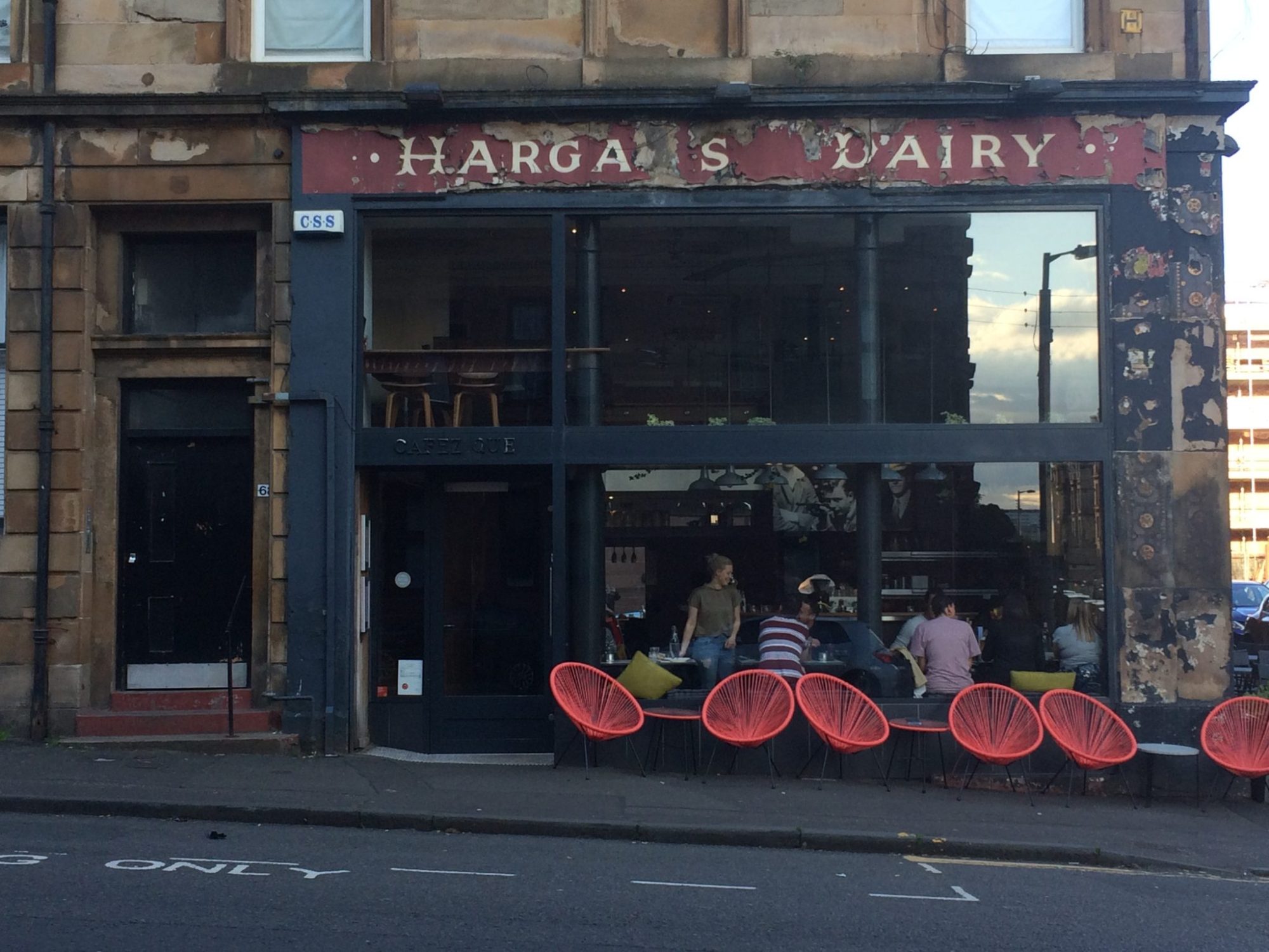
When I signed up to volunteer for the Ghost Signs of Glasgow project, as a Scottish History graduate, my first research assignment was to help research signs in the south side of Glasgow to go on the Ghost Signs of Glasgow Southside map. As I was isolating during the pandemic, the majority of my research began online (no leafing through old papers like Gandalf learning the history of the One Ring for me). Fortunately, as a starting point the team sent me photographs of the signs for the map and a list of helpful websites with online records.
Many of the Ghost Signs of Glasgow social media posts explore the history of the business owner or company whose name is clearly visible on the sign, but the Southside signs I was tasked with were what the team like to call “mystery signs”, these are partial signs with only a few letters uncovered which are barely legible. Later in the pandemic an entire word became visible on one of the signs, unfortunately that word was “GLASGOW” which didn’t help to narrow the search much!

So, my assignment was to tackle the challenging “mystery signs” with no name visible to search for. My research then had to start – and maybe even end – with the addresses, and the buildings themselves. The National Library of Scotland website contains searchable digitised copies of Post Office directories from 1773 to 1912, so this was a good place to start with only an address to work with. A look on the “street view” feature of Google Maps is also a useful tool for examining the signs in context and how they looked even a few years before. When scrutinizing Google Maps closely I discovered a sign on the adjoining building to the one I was researching reading: “Speirs Place”. According to the Historic Environment Scotland website this adjoining building was Category “B” listed while the end building was merely Category “C”. This made me ponder whether the adjoining building was a later addition, and whether there was a piece of local history to explain why the street name was changed to “Queen Mary Avenue”.
A trawl through several old maps on various websites provided no evidence that the street was elongated or renamed, while the Post Office directories indicated that “Speirs Place” was only ever a name for a building on Queen Mary Avenue. It seems that giving tenement buildings their own names used to be a common practice, but that this practice was later discontinued, understandably, because it was confusing for post office staff. Therefore, I’d found another ghost sign in the process of researching the mystery ghost sign on the building adjacent!

I had a bit more good luck when researching another ghost sign, on the corner of Allison Street and Garturk Street. Again, this was one of the challenging “mystery signs”. The few legible letters read “ROC”, suggesting the word “GROCER”. According to records it suggests this was the sign for Margaret King’s grocery, listed in the Post Office directories at that address from 1892-1910. As there are a number of grocers listed at this location it seems this shop has always been a grocery store since the building itself was constructed.
The directories also provided some intriguing clues, for those interested in following a family’s history: after 1910, the shop and the home address belonged to John King, though the shop is still listed as Mrs King’s – therefore this suggests that her son inherited the family business. Other clues suggest that Mrs King used to live above the shop at 21 Garturk Street, and also inherited another shop elsewhere on Allison Street from a husband named Edward before moving to the shop below her flat. There are a number of other grocers named King listed as operating in the same area over the years- could these have been relatives? Although these rabbit-holes take us further away from the sign in question, I found it interesting to speculate about this family’s story, and how they would have been familiar faces within the community.
Helping to research the mystery ghost signs for the Ghost Signs of Glasgow Southside Map was a challenging journey in more ways than one, but mapping the stories of the lives of the people who once lived and worked around this part of Glasgow was a delight, and hopefully provides an insightful look into the past for those that choose to use the maps for their own self-guided adventure!
You can now download and print the Ghost Signs of Glasgow Southside Walking Map here
You might also be interested in...

Glasgow Historic Environment: A Snapshot – 2019
Ever wondered which buildings in your neighbourhood are listed, or even on Scotland’s Buildings at Risk Register? Our new interactive map shows data collated between February and April 2018 which gives a snapshot of the current state of Glasgow’s historic built environment.
Blog Post: Ghosts and Zombies
Read our latest blog post about our Ghost Signs of Glasgow project, pondering the nature of ghost signs and what they tell us about the urban landscape.
